Satellite intelligence
for every farm
AI-powered crop monitoring for smallholder farmers in the global south.
The problem
Farming blind in the 21st century
Smallholder farmers grow 80% of the food in the developing world. Yet they make every decision — when to irrigate, what to plant, whether to harvest — without a single data point.
have zero access to crop health data. They rely on visual inspection — by the time damage is visible, it's already too late.
are preventable with early detection. But without satellite monitoring, pest outbreaks, moisture stress, and nutrient deficiencies go unnoticed until harvest fails.
across the global south from preventable crop failure. Farmers absorb the loss. Lenders can't assess risk. Insurers won't underwrite what they can't measure.
Why hasn't this been solved?
Drones cost $1,000+. Soil sensors cost $500+. Neither scales to millions of farms.
Agricultural advisory is written in English for commercial farms — not in Telugu, Hausa, or Swahili for the farmers who need it most.
Without farm-level data, cooperatives can't plan, lenders can't lend, and insurers can't insure.
The solution
From space to your phone in minutes
Three steps. No hardware. No drones. No field visits required.
Map your farm
Draw boundaries or drop a pin on any device. Works on any phone — no app download required for basic access.
Get satellite analysis
Our AI processes satellite imagery to produce crop health scores, vegetation indices, soil moisture readings, and growth-stage assessments.
Receive advisory
Get actionable recommendations in your language — crop-specific guidance on irrigation, pest risk, fertilization, and harvest timing.
Platform
See what FarmHawk produces
Real outputs from operational farms.
Crop health heatmap
NDVI satellite analysis — vegetation health index mapped across farm boundaries
Crop suitability assessment
AI-driven analysis of soil, climate, and market conditions for optimal crop selection
“మీ పంట ఆరోగ్యం మంచిగా ఉంది. నీటి ఒత్తిడి తక్కువగా ఉంది. వచ్చే వారంలో పొటాషియం ఎరువు వేయండి...”
Multilingual farm advisory
Actionable crop guidance delivered in 14 languages including Telugu, Yoruba, Hindi, and Hausa
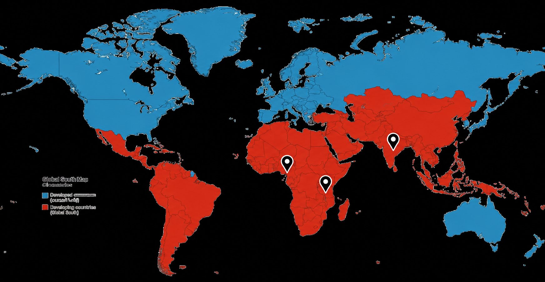
Operational reach
Where FarmHawk is live
Serving smallholder farmers across the global south.
“Awaiting real testimonial from pilot farmers.”
“Awaiting real testimonial from field officers.”

Founder & CEO
Satheesh Paddolker
Built FoodLens (2019), designed microloan models taught at SMU Singapore, Web3 supply chain mentor at CBS Copenhagen. 25 years building financial technology infrastructure across banking, trade finance, and agriculture.
No hardware. No drones.
Just satellite intelligence and your phone.
Built for smallholder farmers
84 crops across diverse agricultural regions. From rice paddies to cocoa plantations.
Speaks your language
Advisory in 14 languages including Telugu, Yoruba, Hindi, Hausa, and Swahili.
Operational now
Live in India, Nigeria, and Kenya. Not a pilot — a working platform with real farms.
Monitor from anywhere
Own farmland but live in the city? Track your land's health remotely — self-service, no field visits needed.
Field Notes
Guides, explainers, and insights
Learn how satellite intelligence, AI, and precision agriculture are transforming farming.
Your Farm Is Talking. Are You Listening?
Satellite intelligence detects crop stress weeks before the human eye can. Here's why timing is the difference between a good harvest and a devastating loss for 500 million smallholder farmers.
8 min readFarmer guide3 Silent Killers Stealing Smallholder Farmers' Income — And How to Fight Back
Climate shocks, hidden crop stress, and lack of market leverage are eroding the livelihoods of millions of smallholder farmers. Here's how satellite intelligence is changing the equation.
8 min readFarmer guideWhat is NDVI? A farmer's guide to satellite crop health monitoring
NDVI (Normalized Difference Vegetation Index) is the core measurement behind satellite crop monitoring. Learn how NDVI works, what the scores mean, and how farmers use it to detect crop stress early.
5 min readFAQ
Frequently asked questions
FarmHawk is an AI-powered satellite crop intelligence platform. It converts satellite imagery into actionable farm advisory — crop health scores, yield predictions, suitability assessments, and risk alerts — delivered in 14 languages, with no hardware required.
FarmHawk uses Sentinel-2 satellite imagery to analyze your farm remotely. Our AI processes multispectral data to measure vegetation health (NDVI), soil moisture, growth stage, and stress indicators. You receive a detailed report with actionable recommendations.
No. FarmHawk works entirely from satellite imagery. There is no hardware to purchase, no drones to fly, no sensors to install, and no field visits required. You only need a phone or computer.
FarmHawk currently supports 84 crops across diverse agricultural regions — including rice, wheat, sugarcane, coconut, cocoa, cotton, cassava, maize, oil palm, bamboo, brinjal, and many more.
FarmHawk delivers advisory in 14 languages including English, Telugu, Hindi, Kannada, Tamil, Marathi, Yoruba, Hausa, Igbo, Swahili, French, Spanish, Portuguese, and Arabic.
Cooperatives use FarmHawk to monitor crop health across all member farms, generate seasonal reports, identify at-risk plots early, and provide data-driven advisory to their farmers at scale.
FarmHawk generates three types of reports: Farm Health Analysis, Crop Suitability Intelligence, and Commercial Viability Assessment.
FarmHawk is live in India (Andhra Pradesh, Telangana), Nigeria (Lagos region), and Kenya (Nairobi region). The platform supports farms in any location with satellite coverage.
AI models analyze satellite imagery, crop growth patterns, weather variability, soil conditions, and market trends to produce actionable farm intelligence in the farmer's preferred language.
Yes. FarmHawk supports climate resilience analytics, resource efficiency insights, sustainable agriculture optimization, and environmental monitoring.
Verified satellite farm intelligence can improve risk assessment for agricultural lenders, crop insurance underwriting, and farm productivity benchmarking.
FarmHawk is built by Kratos Innovation Labs Limited, led by Satheesh Paddolker — a FinTech veteran with 25+ years of experience.
Yes. FarmHawk's self-service model is designed for anyone who owns agricultural land, including absentee landowners.
Absolutely. FarmHawk uses satellite imagery, so physical access to the farm is not required. You can monitor from anywhere in the world.